The highest mountains of the United States show the natural power and beauty of the land. From the icy Denali peak in Alaska to the tall Whitney mountain in California, each of these towering mountains tells a story of time, climate, and earth’s movement. Many travelers dream of standing atop these top summits, breathing in the thin air, and seeing the world below.
In this guide, you’ll learn about the USA summits that rise above the rest. You’ll explore major peaks, understand the elevation records, and discover what makes each region’s mountainous terrain unique. Whether you’re drawn to the Cascade crests, the Appalachian crests, or the Sierras, this is your complete look at the country’s most amazing pinnacle points.
What is the Highest Mountain in the USA?

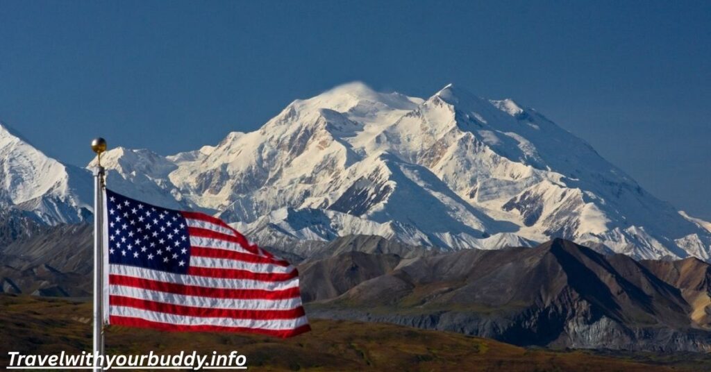
The tallest and most powerful of all American peaks is Denali. Once called Mount McKinley, this Alaskan giant towers at 20,310 feet above sea level. The Denali summit is part of the Elias Range in Alaska, a wild and freezing place. It’s the highest peak not just in the United States, but in all of North America.
The Denali elevation is so extreme that even its base-to-peak rise is larger than Mount Everest’s. The air is thin, and storms are fierce. Only trained climbers dare reach this mountain apex. First climbed in 1913, it still tests those who try to reach its summit altitude today.
Mountain Ranges in the United States
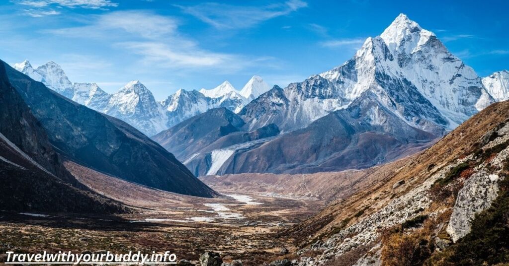
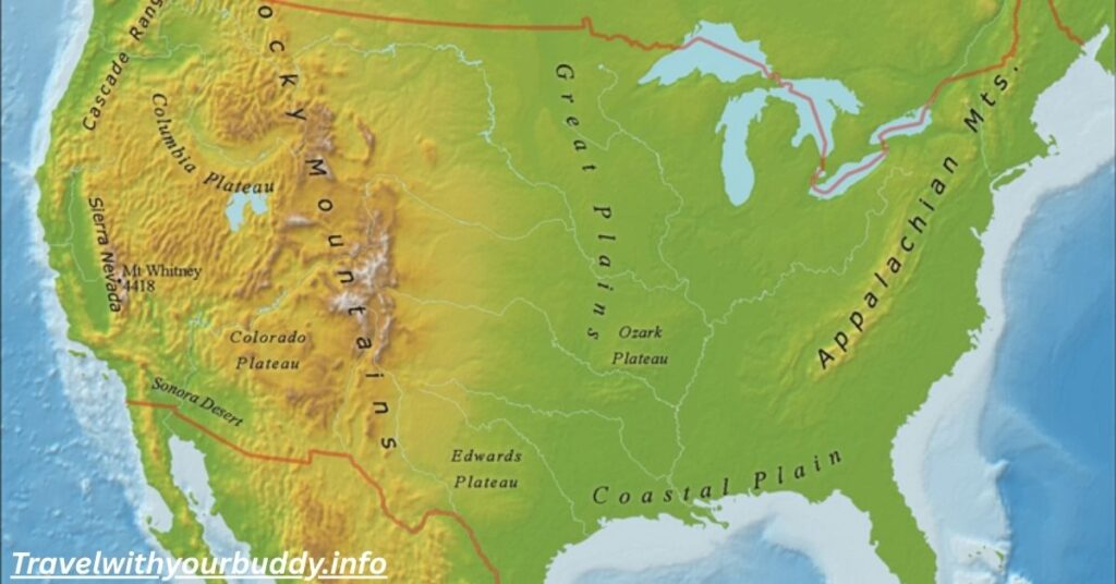
The U.S. has many long mountain chains that stretch across the land. Each has its own look, climate, and history. The Rockies are perhaps the most famous. They stretch over 3,000 miles through the western part of the country. These western mountains hold many of the top elevations in the continental U.S.
To the west, the Sierra range runs through California and Nevada. This high Sierras region includes the famous Whitney peak. The Cascade range lies further north. Its Cascade summits and Cascade elevations include volcanoes like Mount Rainier and Mount Hood. To the east, the older Appalachian range rises gently. These eastern mountains offer rolling hills and thick forests, part of a long mountain range with deep cultural ties.
Statistics on “Geography of the United States”
The United States covers over 3.8 million square miles. Its geography includes deserts, plains, lakes, and range of mountains, Its lowest point is Badwater Basin in Death Valley at 282 feet below sea level. Its highest, of course, is the Denali summit in Alaska.
There are five main mountain belts in the U.S.: the Rockies, Sierras, Cascades, Appalachians, and the Alaska Range. Together, they shape much of the land’s height and beauty. The table below shows a few key facts.
| Feature | Location | Elevation |
| Highest Peak | Denali, Alaska | 20,310 ft |
| Lowest Point | Badwater Basin, CA | -282 ft |
| Tallest Non-Alaska Peak | Mount Whitney, California | 14,505 ft |
| Oldest Range | Appalachian Mountains | ~480 million years |
| Largest Range | Rocky Mountains | ~3,000 miles long |
How Many Mountains are in the United States?
It’s hard to count the exact number of states’ peaks. That’s because there’s no strict rule for what makes a mountain. Some count only named peaks. Others include all points above a set peak elevation.
Still, the U.S. is home to thousands of mountain vistas. Just the state of Colorado has over 50 peaks above 14,000 feet. Alaska has even more, thanks to its high-range Elias and Denali elevation. Each mountain belt adds hundreds of peaks to the total.
Highest Elevations in Each State or Territory of the United States (in feet above sea level)
Every state has a top summit that marks its tallest point. Some are small hills. Others are massive climbs. Here’s a short table with examples of the top elevations in a few key states:
| State | Highest Point | Elevation (ft) |
| Alaska | Denali | 20,310 |
| California | Whitney high point | 14,505 |
| Colorado | Mount Elbert | 14,440 |
| Washington | Mount Rainier | 14,411 |
| North Carolina | Mount Mitchell | 6,684 |
| Florida | Britton Hill | 345 |
Even flat states like Florida have a summit height. But the real giants are found in the western mountains, especially in Alaska and the Rockies.
Top 10 Highest Mountains in United States
The USA summits with the highest summit altitude are nearly all in Alaska. They belong to the Elias summits and Denali peak cluster. These national mountains rise above 14,000 feet and are known for ice, snow, and danger.
| Rank | Mountain Name | Elevation (ft) | Location |
| 1 | Denali | 20,310 | Alaska |
| 2 | Mount Saint Elias | 18,009 | Alaska/Yukon |
| 3 | Mount Foraker | 17,400 | Alaska |
| 4 | Mount Bona | 16,550 | Alaska |
| 5 | Mount Blackburn | 16,390 | Alaska |
| 6 | Mount Sanford | 16,237 | Alaska |
| 7 | Mount Fairweather | 15,325 | Alaska/BC |
| 8 | Mount Hubbard | 14,951 | Alaska/Yukon |
| 9 | Mount Bear | 14,831 | Alaska |
| 10 | Mount Hunter | 14,573 | Alaska |
Which U.S. State Has the Highest Mountains?
The clear answer is Alaska. Its Elias peaks, Elias elevations, and Denali elevation are unmatched. It holds 13 of the 15 tallest top elevations in the country.
No other state has such a concentration of peak clusters or massive mountain apex heights. Alaska is not just cold, but tall, wild, and breathtaking.
What is the Tallest Mountain in the US That’s Not in Alaska?
That honor goes to Whitney mountain in California. It’s part of the Sierra range and reaches 14,505 feet. This California summit is the Whitney high point and stands tall in the Eastern Sierra.
The climb is popular and beautiful. It’s also near Death Valley, the lowest point in North America. That makes for a wild contrast between low desert and snowy Whitney peak.
Which is Taller: The Rockies or the Andes?
The Rockies are high, but the Andes are taller. The tallest Rockies peak is Mount Elbert at 14,440 feet. But Aconcagua in the Andes reaches 22,841 feet. That’s almost 8,400 feet higher.
Still, the Rockies are longer within the U.S. and part of the famous Great Divide, which splits the flow of rivers between oceans. They are the most famous long mountain range in America.
Other Statistics That May Interest You – Geography of the United States
The U.S. has over 70 peaks higher than 14,000 feet. Most are in Alaska and Colorado. The tallest Cascade summits are Mount Rainier and Mount Shasta. The Cascade range includes active volcanoes.
Many elevation records are also weather-related. Mount Rainier once got 93 feet of snow in one season. That’s a record for the lower 48 states.
FAQ’s: The Highest Mountains of the United States
How tall is Denali?
It’s 20,310 feet. That makes the Denali summit the tallest point in North America.
What’s the tallest U.S. peak not in Alaska?
That’s Whitney mountain in California. It’s 14,505 feet high.
Which range is the longest in the US?
The Rockies, stretching over 3,000 miles.
Are there mountains on the East Coast?
Yes, the Appalachians and Appalachian crests run through eastern states like North Carolina and New Hampshire.
Is Denali harder to climb than Everest?
It can be. Weather on Denali peak is colder and storms come fast. Climbers face real danger.
I’m Freya Collins, an experienced travel writer passionate about helping others explore the world. At TravelWithYourBuddy.info, I share practical tips, guides, and insights from my journeys to inspire confident and meaningful adventures.